

The url of my server is https://namirda.dynamic-dns.net as you can see in the MB window on your screen.
However it is not a website as such - just a server.
N

You are using an out of date browser. It may not display this or other websites correctly.
You should upgrade or use an alternative browser.
You should upgrade or use an alternative browser.
Virtual Litchi Mission
- Thread starter namirda
- Start date
Why the window of waypoint editor become small and not full windows ?Download latest version here :
Virtual Litchi Mission V2.5.0
---------------------------------------------------------------------------------------------------------------------
VLM Frequently Asked Questions
Problems Getting Started
Q) VLM does not start properly – startup sound and splash screen and then nothing!
A) Restart VLM while pressing CTRL and you will be given the option to reset VLM to initial conditions
Q) The Litchi Mission Hub panel in VLM is shifted from its expected location?
A) Try running in compatibility mode by right clicking on the VLM icon and choose
Compatibility tab -> Change High DPI Settings -> High DPI Scaling Override.
Q) VLM runs but Google Earth does not open?
A) Check that Google Earth Pro is properly installed and that kml files are properly associated with Google Earth. You can check this by double clicking on a kml file and confirming that Google Earth opens.
Q) VLM crashes on startup complaining about 'CefSharp.Core.dll' or one of its dependencies.
A) Check that the following are properly installed on your system:
Microsoft Visual C++ 2015 Redistributable (x64)
Microsoft Visual C++ 2013 Redistributable (x64)
Microsoft .NET Framework 4.6
Q) Can I run VLM on a Mac?
A) VLM is a windows only application. You have two options to run on a Mac or Linux machine
1) Apparently VLM runs well in a Virtual Machine such as Parallels2) User Bazuchan has implemented a version of VLM which runs as an extension to the browser. Yet another Virtual Litchi Mission (Google Chrome Extension)Q) I get a message about my quota being exceeded - what's up?
A) VLM uses the Google Elevation API to get its elevation information using an API key which is shared between all users. If usage of this key exceeds a certain daily limit then you will need to either wait until the next day when the quota is reset - or else get your own key from Google. You can open an account with Google at https://console. cloud.google.coms. Google will require you to enter your credit card details but unless your usage of VLM exceeds 40,000 hits in a month you should not be charged anything. You can enter your own API key into VLM in the Google Tab of VLM Settings.
Problems with the Virtual Mission
Q) The elevations of my virtual mission look wrong
A) Check the following:
1) The exaggeration factor in Google Earth should be set to 1.02) Check that Litchi Mission Hub, VLM and GE are all using either Imperial or Metric units – do not mix them.3) Check that the VLM Home Point Reference Altitude is appropriate for your mission. If you are unsure then use the default setting of WP1 and put the first WP of your mission directly above the Home Point (Take Off Point)4) If there are still small elevation differences then compare the elevation of the Home Point in both Google Earth and Google Maps (ie Litchi). If they are significantly different then set the VLM HP altitude to the elevation measured by Google Earth.
Q) The VLM Mission is a poor match with the real mission
A) Check the following:
1) Check that you have specified a heading and gimbal angle for every waypoint of your mission. If any of these values are undefined you will see an orange warning in the VLM Activity Log.2) Check that your mission does not exceed the capabilities of your drone. Any such issues will be highlighted in orange in the VLM Activity Log and should be addressed.3) Check that the Google Earth viewing window is set to 16:9 to match your camera settings.4) Check that the drone type is set correctly in VLM and that the FOV setting is correct.5) Check that the VLM Cruising speed matches the setting in the Litchi Mission Hub.6) If the VLM mission is jerky then try increasing the number of smoothing points.
If you still have questions or problems then please ask in this thread.
---------------------------------------------------------------------------------------------------------------------------
Original post dated 26/12/2017:
In this thread started almost a year ago - https://mavicpilots.com/threads/how-hard-would-it-be-to-simulate-litchi-missions-in-google-earth.7864, user “torqum” introduced the intriguing idea ‘flying’ a Litchi mission virtually in Google Earth to see how it looks from the perspective specified in Litchi. It was a very appealing concept – to fly a mission anywhere in the world without getting out of your armchair!
In that thread, user "JTS" submitted a conversion program which apparently worked for some folks but not for others – and not for me so I decided to write my own.
The utility is called Virtual Litchi Mission (VLM) – it is a standalone executable and does not need any installation. It runs on my Win10 x64 machine but should run on x86 machines as well. On older versions of windows your mileage may vary…..
VLM sets a watch on a user specified Downloads folder and will automatically read any csv file created in this folder. When Litchi Mission Hub writes a csv file to this folder, VLM will convert it to a “Tour” in Google Earth including the complete camera orientation and gimbal settings which were specified in Litchi.
The resulting Virtual Mission can then be flown in Google Earth and should show results very similar to that obtained when the mission is flown with your drone. I have tried it out on quite a few of the public missions available in Litchi Mission Hub and in areas where the satellite imagery is good, the results are impressive. Google Earth is so amazing!!
I have found VLM useful to check that there are no erroneous parameters in my Litchi Mission and to check that the camera ‘sees’ what I want it to see. It has saved me several wasted flights with my mavic.
A full User Guide is available in VLM under the Help Tab
Please give VLM a try and let me have any feedback, comments etc. I hope you find it useful.
Thanks
N
Attachments
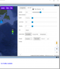
The Litchi waypoint editor does not scale properly when you resize the window . So to see the complete waypoint editor you need to close the lower profile window.Why the window of waypoint editor become small and not full windows ?
N
TKS, Namirda. I check my laptop and resolution of screen is exactly as 1920x1080(FHD). I do not understand the way to close the lower profile window. Thank for your help in advance. When I install VML couple month ago, it is fine but just change this week.The Litchi waypoint editor does not scale properly when you resize the window . So to see the complete waypoint editor you need to close the lower profile window.
N
I just uninstall it and reinstall VML 2.50, now it is OK. I do not understand which issue I change the window size of WP editor. Anyway, thank again for your prompt response .The Litchi waypoint editor does not scale properly when you resize the window . So to see the complete waypoint editor you need to close the lower profile window.
N
Robert Granata
Well-Known Member
- Joined
- Dec 25, 2016
- Messages
- 367
- Reactions
- 381
- Age
- 69
Same problem here. Not working on both computers. Doesn't seem to be generating the CSV file, as far as I can tell. Chrome extension works fine.Namirda, today I have this issue when export to CSV and can not open Google Earth Pro. In Chrome, Litchi Hub with VLM extension is working to generate KML file and open with GE is fine.
Please see attached screenshot.
But after one week, it be
But after one week, it become OK now. I slide the screen display scale from 125% to 100% than waypoint editor display is full screen now.Same problem here. Not working on both computers. Doesn't seem to be generating the CSV file, as far as I can tell. Chrome extension works fine.


Prismatic
Well-Known Member
En utilisant simplement Google Translate. Lorsque Litchi crée un fichier CSV pour une mission, le fichier n'inclut pas la vitesse de croisière ou le mode cap. Par conséquent, VLM a besoin d'une source pour ces informations, qu'elle obtient à partir des paramètres de mission de VLM. Les paramètres du Mission Hub s'appliquent au vol réel, tandis que les paramètres de VLM s'appliquent uniquement à la mission virtuelle. Ils doivent correspondre ou la mission virtuelle ne sera pas fidèle à la vraie mission.

Merci pour votre réponse, mais qui amène alors une autre question pour moi:
Quel est le mode 'normal' pour créer une mission?
-La créer directement dans VLM, l'export CSV démarrant la visualisation dans Google Earth?
-Ou la créer dans Mission hub, et en exportant le CSV dans le dossier d'attente de VLM, démarrer le processus décrit dessus?
Merci
Quel est le mode 'normal' pour créer une mission?
-La créer directement dans VLM, l'export CSV démarrant la visualisation dans Google Earth?
-Ou la créer dans Mission hub, et en exportant le CSV dans le dossier d'attente de VLM, démarrer le processus décrit dessus?
Merci
Prismatic
Well-Known Member
VLM a Mission Hub intégré dans l'interface, donc - si je comprends votre question - les deux façons sont équivalentes. Je préfère travailler exclusivement en VLM. Cette conversation serait plus facile si je parlais français ou si vous parliez anglais, mais Google Translate est mieux que rien!Merci pour votre réponse, mais qui amène alors une autre question pour moi:
Quel est le mode 'normal' pour créer une mission?
-La créer directement dans VLM, l'export CSV démarrant la visualisation dans Google Earth?
-Ou la créer dans Mission hub, et en exportant le CSV dans le dossier d'attente de VLM, démarrer le processus décrit dessus?
Merci
VLM a Mission Hub intégré dans l'interface, donc - si je comprends votre question - les deux façons sont équivalentes. Je préfère travailler exclusivement en VLM. Cette conversation serait plus facile si je parlais français ou si vous parliez anglais, mais Google Translate est mieux que rien!
Thank you, that finally answers my question (which I also asked in English, but which was automatically translated into French by Chrome).
pmshop
Well-Known Member
I have designed this flight a while back with no issues.
It would go out to WP1,
head out facing WP2
Turn to face direction of travel by WP3
Head out to WP4
Turn to face direction of travel by WP 5
and so on.
I moved the WP3 and WP5 by 25ft and when I run the flight through a simulator, once it reaches WP2 headed to WP3, the view (aircraft) just spins and spins instead of one roughly 180° turn to WP3
The spinning stops once it reaches WP3
Same happens for WP4 and WP5
I have tried every setting I can think of to resolve.
Please advise
Attachments

The Fat Controller
Well-Known Member
I had the same problem. Press F11 to resolve.Hello,
how to remedy this display problem on a 14 inch laptop PC in 1920x1080?
View attachment 93057Thank you
I had the same problem. Press F11 to resolve.
It's not ideal, but it's better.
 Thank you
pmshop
Well-Known Member
It's not ideal, but it's better.
View attachment 93059Thank you
I have huge screens so I cannot test but try CTRL and - a few times.
CTRL and + to get back to where you were.
Also check to see if the recommended resolution and scaling is used in settings.
Try rolling back the scaling to 100% or less just to use the HUB.
Similar threads
- Replies
- 5
- Views
- 3K
- Replies
- 1
- Views
- 758
- Replies
- 9
- Views
- 623
- Replies
- 7
- Views
- 3K


DJI Drone Deals
Members online
Total: 5,508 (members: 12, guests: 5,496)
Forum statistics
