DJI Mavic, Air and Mini Drones
Friendly, Helpful & Knowledgeable Community
Join Us Now

Virtual Litchi Mission

Download latest version here :
Virtual Litchi Mission V2.5.0

---------------------------------------------------------------------------------------------------------------------

VLM Frequently Asked Questions

Problems Getting Started


Q) VLM does not start properly – startup sound and splash screen and then nothing!
A) Restart VLM while pressing CTRL and you will be given the option to reset VLM to initial conditions

Q) The Litchi Mission Hub panel in VLM is shifted from its expected location?
A) Try running in compatibility mode by right clicking on the VLM icon and choose

Compatibility tab -> Change High DPI Settings -> High DPI Scaling Override.

Q) VLM runs but Google Earth does not open?
A) Check that Google Earth Pro is properly installed and that kml files are properly associated with Google Earth. You can check this by double clicking on a kml file and confirming that Google Earth opens.

Q) VLM crashes on startup complaining about 'CefSharp.Core.dll' or one of its dependencies.
A) Check that the following are properly installed on your system:
Microsoft Visual C++ 2015 Redistributable (x64)
Microsoft Visual C++ 2013 Redistributable (x64)
Microsoft .NET Framework 4.6

Q) Can I run VLM on a Mac?
A) VLM is a windows only application. You have two options to run on a Mac or Linux machine

1) Apparently VLM runs well in a Virtual Machine such as Parallels​
2) User Bazuchan has implemented a version of VLM which runs as an extension to the browser. Yet another Virtual Litchi Mission (Google Chrome Extension)
Q) I get a message about my quota being exceeded - what's up?
A) VLM uses the Google Elevation API to get its elevation information using an API key which is shared between all users. If usage of this key exceeds a certain daily limit then you will need to either wait until the next day when the quota is reset - or else get your own key from Google. You can open an account with Google at https://console. cloud.google.coms. Google will require you to enter your credit card details but unless your usage of VLM exceeds 40,000 hits in a month you should not be charged anything. You can enter your own API key into VLM in the Google Tab of VLM Settings.

Problems with the Virtual Mission

Q) The elevations of my virtual mission look wrong
A) Check the following:
1) The exaggeration factor in Google Earth should be set to 1.0​
2) Check that Litchi Mission Hub, VLM and GE are all using either Imperial or Metric units – do not mix them.​
3) Check that the VLM Home Point Reference Altitude is appropriate for your mission. If you are unsure then use the default setting of WP1 and put the first WP of your mission directly above the Home Point (Take Off Point)​
4) If there are still small elevation differences then compare the elevation of the Home Point in both Google Earth and Google Maps (ie Litchi). If they are significantly different then set the VLM HP altitude to the elevation measured by Google Earth.​

Q) The VLM Mission is a poor match with the real mission
A) Check the following:
1) Check that you have specified a heading and gimbal angle for every waypoint of your mission. If any of these values are undefined you will see an orange warning in the VLM Activity Log.​
2) Check that your mission does not exceed the capabilities of your drone. Any such issues will be highlighted in orange in the VLM Activity Log and should be addressed.​
3) Check that the Google Earth viewing window is set to 16:9 to match your camera settings.​
4) Check that the drone type is set correctly in VLM and that the FOV setting is correct.​
5) Check that the VLM Cruising speed matches the setting in the Litchi Mission Hub.​
6) If the VLM mission is jerky then try increasing the number of smoothing points.​

If you still have questions or problems then please ask in this thread.
---------------------------------------------------------------------------------------------------------------------------

Original post dated 26/12/2017:

In this thread started almost a year ago - https://mavicpilots.com/threads/how-hard-would-it-be-to-simulate-litchi-missions-in-google-earth.7864, user “torqum” introduced the intriguing idea ‘flying’ a Litchi mission virtually in Google Earth to see how it looks from the perspective specified in Litchi. It was a very appealing concept – to fly a mission anywhere in the world without getting out of your armchair!

In that thread, user "JTS" submitted a conversion program which apparently worked for some folks but not for others – and not for me so I decided to write my own.

The utility is called Virtual Litchi Mission (VLM) – it is a standalone executable and does not need any installation. It runs on my Win10 x64 machine but should run on x86 machines as well. On older versions of windows your mileage may vary…..

VLM sets a watch on a user specified Downloads folder and will automatically read any csv file created in this folder. When Litchi Mission Hub writes a csv file to this folder, VLM will convert it to a “Tour” in Google Earth including the complete camera orientation and gimbal settings which were specified in Litchi.

The resulting Virtual Mission can then be flown in Google Earth and should show results very similar to that obtained when the mission is flown with your drone. I have tried it out on quite a few of the public missions available in Litchi Mission Hub and in areas where the satellite imagery is good, the results are impressive. Google Earth is so amazing!!

I have found VLM useful to check that there are no erroneous parameters in my Litchi Mission and to check that the camera ‘sees’ what I want it to see. It has saved me several wasted flights with my mavic.

A full User Guide is available in VLM under the Help Tab

Please give VLM a try and let me have any feedback, comments etc. I hope you find it useful.

Thanks

N
I had this running fine until I purchased the litchi app. I have Windows 7 Home Premium with 'No' problems. Now, I have re-download (5 times) the VLM from your link - it installs, & leaves a shortcut on the desktop. But 'now' when I click on the shortcut icon, it makes the start up noise, but nothing else. Before, it opened and I could plan a mission, export to Google Earth, and play & watch the whole mission it as though I was sitting on
the drone. I have tried the fixes mentioned here under 'Frequently Asked Question'... but so far, nothing has worked. I get the message that it has returned to it's initial state, but still the program will not come up on the screen. I loved this program too. Please... any help would be greatly appreciated.

I ran into the same thing when I installed the latest version. It's now installed under the name Virtual Litchi Mission. If you type or click on VLM, it will try to call up the old version. So type Virtual Litchi Mission in the search box on the Windows start menu and the correct link will show up.
 
I ran into the same thing when I installed the latest version. It's now installed under the name Virtual Litchi Mission. If you type or click on VLM, it will try to call up the old version. So type Virtual Litchi Mission in the search box on the Windows start menu and the correct link will show up.
Ran across, accidently, info about Chrome Virtual Litchi Mission 'Chrome Extension', & installed in Chrome as extension. (this is all so foreign to me) Now Litchi Hub (not the VLM Version) has the option to export the mission as a 'VLM'. I no longer have the ?? VLM ?? 'Program' on my desktop. I just start out in the 'regular' Litchi Hub- no need for the VLM now I guess. Seems to now work as before, but it took me all day to "Accidently" come across this. I'm keeping my fingers crossed... no further headaches, but I know how that goes. lol Thanks so much for your reply ThorDar.
 
Last edited:
Help! Newbie elevation problems with VLM and Earth Pro.
Hi, I'm trying to get VLM to launch Google Earth Pro with correct EYE ALTITUDE. I've played with the buttons but no matter what the eye altitude is way to high (like 5000 feet above ground level). If I change vertical exaggeration to 1.0 as recommended, my waypoints shoot up into the sky. I can zoom down and see my flight path but as soon as I play the virtual mission, Google Earth Pro zooms way out and plays the flight path at an altitude thousand of feet above the correct camera view. Funny enough, I can export the same path into Google Earth on the web using the Chrome extension and the altitudes are flown correctly? I've played with every button I can find but I'm lost. Any help most appreciated. Thanks in advance.
 
Last edited:
  • Like
Reactions: BigAl07
Help! Newbie elevation problems with VLM and Earth Pro.
Hi, I'm trying to get VLM to launch Google Earth Pro with correct EYE ALTITUDE. I've played with the buttons but no matter what the eye altitude is way to high (like 5000 feet above ground level). If I change vertical exaggeration to 1.0 as recommended, my waypoints shoot up into the sky. I can zoom down and see my flight path but as soon as I play the virtual mission, Google Earth Pro zooms way out and plays the flight path at an altitude thousand of feet above the correct camera view. Funny enough, I can export the same path into Google Earth on the web using the Chrome extension and the altitudes are flown correctly? I've played with every button I can find but I'm lost. Any help most appreciated. Thanks in advance.
Make sure that your "HP Altitude Reference" is set to WP1, that "Above Ground" is disabled for all WPs in your mission and that the Units and Cruising Speed set in VLM match those you have selected in Litchi. With those 'default' settings,everything should work correctly. If you still have problems then post a link to your mission here and I can take a look at it.

N
Hi Namirda,
Thanks for the quick reply. I think I've gone through all those carefully but will confirm 100% and update soon.
 
  • Like
Reactions: BigAl07
Hi Namirda,
Thanks for the quick reply. I think I've gone through all those carefully but will confirm 100% and update soon.
Hi Namirda,
I think I've missed something. I can't find home point altitude reference or how to set it to WP1. I see in the green text that it is set to WP1 but I'm not finding the field. Thanks and sorry for the noob questions.
 
Hi Namirda,
I think I've missed something. I can't find home point altitude reference or how to set it to WP1. I see in the green text that it is set to WP1 but I'm not finding the field. Thanks and sorry for the noob questions.
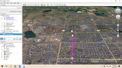
OK, I found it in VLM and it was set correctly. I forgot about it and was looking at web mission planner. I think the problem is with Google Earth Pro. I've uninstalled it but I notice upon reinstall that old points are retained so I think there is a config file I need to delete before reinstalling. Here's an example exported to csv from web version saved by VLM and screenshot of GEP showing eye altitude some 5000 ft above ground level. Forum won't let me post csv file. Where can I post csv?. THANKS!

1609375790023.png
 
OK, I found it in VLM and it was set correctly. I forgot about it and was looking at web mission planner. I think the problem is with Google Earth Pro. I've uninstalled it but I notice upon reinstall that old points are retained so I think there is a config file I need to delete before reinstalling. Here's an example exported to csv from web version saved by VLM and screenshot of GEP showing eye altitude some 5000 ft above ground level. Forum won't let me post csv file. Where can I post csv?. THANKS!

Simplest way is to post the link to your mission in the Mission Hub. Make sure to untick the 'Private' box or else I won't be able to open it.

N
 
Hi,

I have taken a quick look at your mission :

1) The 'eye at' number which you see in Google Earth is the absolute altitude - not the altitude relative to the ground. Your WP1 is at 5145 ft above sealevel (according to the Google Elevation API) and the maximum elevation above WP1 in your mission is 351 ft and so you should expect to see eye elevations in Google Earth in the range 5145 to 5496 as you fly your mission. This range may not be exact because VLM gets its elevation from the Google Elevation API which, surprisingly, does not use the same elevation model as Google Earth.

2) As per above, elevation values are not precise - and for that reason you should avoid using an elevation of zero for the first WP. This is why you see the virtual mission bumping along the ground for the first few seconds and your drone may do the same if you fly this mission! Much better to set both the first and last WP of the mission close to the Take Off Point and to use a safe elevation of something like 10m for both.

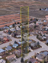
3) Some of your WPs are very close together and have extreme elevation changes - in fact the vertical distance is greater then the horizontal distance in some cases! This could lead to unexpected effects if the GPS or elevation accuracy is less than excellent.

4) You didn't say what you are trying to achieve with this mission but if you are trying to get smooth video then you need to avoid sudden and dramatic changes in heading, elevation and bearing between adjacent WPs.

Hope this helps

N
 
Last edited:
  • Like
Reactions: stavok
FWIW, I tried the mission as well. The 4m13s route did not appear to bump along the ground, but rose at a reasonable pace, then move a little before descending.
1609494522455.png
It seemed okay to me as some kind of test mission, or as a quick look around town.
 
  • Like
Reactions: stavok
Hi Namirda,
I finally tried on another machine and can confirm the altitude problem was with Google Earth Pro. I had uninstalled GEP on my machine but noticed some points were retained when reinstalled. There is obviously an undeleted configuration file with a parameter permanently breaking GEP. Looks great on a fresh install on new machine.

Yes, the file was designed as a software test. Just trying to confirm how angles are referenced, rotation direction convention, etc... Now that it works I will make much faster progress as I had spent many hours pulling hair out thinking I was messing up the buttons.

Thanks so much for the helpful flight comments. I'm planning to fly fully autonomous missions so now I can fine tune flight paths for best video.

Did you write this yourself? Very impressive and useful and THANKS again for creating it.

One last question, if I x out of the lower flight profiles window, how do I get it back?

Happy New Year!

Facherty thanks for test as well :)
 
  • Like
Reactions: Prismatic

Please try above. THanks.
A few weeks ago I wanted to see if Litchi could approximate a horizontally-stationary vertical climb, rather like your mission. I laid out a short mission in a vacant lot, with an ultra-steep ascent (87.5°) and a similar ultra-steep descent. I was very careful to never exceed my drone's maximum climb/descent rates.

Bad news ensued.

With straight-lines set, the virtual mission showed a wild, whirling, looping flight that deviated, near the inclines, by a hundred yards from the expected--and correctly depicted--flight path! The virtual flight did end, I'm happy to say, at the right location, but the virtual mission was plainly beyond the ability of VLM (or upstream, maybe Litchi itself) to handle. I didn't want to see my bird disappearing in the distance on account of it in a field test.

But VLM suggested it might (sorta) work with curved turns. The field test was a failure: the drone reached the sharp rise, and began oscillating in place--it's hard to describe--as if it's navigator was in an infinite loop between two very-tightly-spaced WPs. I eventually bailed out when it was clear this was going nowhere.

Summary: Litchi has a limit when it comes to how steep a leg can be, even if the leg is technically within the vertical-speed parameters of your drone. Finding the limiting angle would require some testing, and may vary between drones, but suffice it to say that given my test, I'm not the least surprised at the way your mission "works".

Glad to hear you've solved the GEP issue. Happy New Year!
 
Last edited:
  • Like
Reactions: stavok
There are two buttons above the main Litchi window - one toggles the profile window and the other toggles the log window.

N
..oh wait, one LAST question. I've flown my first two amazing flights now with video I can't stop reviewing. The waypoint interpolation and moving from focus POI to fixed gimble tilt angles seems to be working great and video is great BUT, no pictures? I've got the "Photo Capture Interval" set at 5 seconds but I get zero photos. Truth is, I'm not confident the camera is starting automatically as instructed as both times I chickened out and hit the record button on the app since it seemed it didn't start as instructed (ah, at WP1 because it never reached WP1?). Similarly, it didn't stop recording at the end (catching my rough landings) because it never reached the final WP ?

1. Can I take photos (e.g. every 5 seconds) while continuously recording Video? If so, why didn't it work?

2. I understand the WP defined actions not being reached with curved paths (older software?), but the flight starts and ends with WP's that should trigger video record start and stop?

Thanks for helping me get off the ground!

ps. OK, I guess this is my third question. Is it described anywhere the conventions for orientation changes as executed and extrapolated between waypoints? i.e. If I define a heading or camera angle at a waypoint, is that the exact starting position to be assumed once the waypoint is reached and the next waypoint will be blended in "weighted down the road" or smoothed in so the aircraft has already achieved orientation by the time WP is approached or ? I'm trying to understand how actions such as rotate aircraft at a waypoint are defined or implemented?
1 & 2) All WP actions are ignored when the mission "Path Mode" is set to "Curved Turns" VLM ignores actions as well.

3) The heading and pitch defined in your mission for a given WP will be the heading and pitch of your quad at the closest point of approach to the WP with simple linear interpolation between. The path taken by the drone near a WP is a bezier curve defined by the curve size chosen. The story gets a bit more complicated when you are using POIs - you will find a discussion about that earlier in this thread.

In the VLM mission diagnostics in GE, it can be helpful to select "WP Views" for each WP and see what the camera will be doing at each WP.

Hope that helps

N
 
  • Like
Reactions: Prismatic
1 & 2) All WP actions are ignored when the mission "Path Mode" is set to "Curved Turns" VLM ignores actions as well.

3) The heading and pitch defined in your mission for a given WP will be the heading and pitch of your quad at the closest point of approach to the WP with simple linear interpolation between. The path taken by the drone near a WP is a bezier curve defined by the curve size chosen. The story gets a bit more complicated when you are using POIs - you will find a discussion about that earlier in this thread.

In the VLM mission diagnostics in GE, it can be helpful to select "WP Views" for each WP and see what the camera will be doing at each WP.

Hope that helps

N
VERY useful information! Thanks so much for your help.
 
..oh wait, one LAST question. I've flown my first two amazing flights now with video I can't stop reviewing. The waypoint interpolation and moving from focus POI to fixed gimble tilt angles seems to be working great and video is great BUT, no pictures? I've got the "Photo Capture Interval" set at 5 seconds but I get zero photos. Truth is, I'm not confident the camera is starting automatically as instructed as both times I chickened out and hit the record button on the app since it seemed it didn't start as instructed (ah, at WP1 because it never reached WP1?). Similarly, it didn't stop recording at the end (catching my rough landings) because it never reached the final WP ?

1. Can I take photos (e.g. every 5 seconds) while continuously recording Video? If so, why didn't it work?

2. I understand the WP defined actions not being reached with curved paths (older software?), but the flight starts and ends with WP's that should trigger video record start and stop?

Thanks for helping me get off the ground!

ps. OK, I guess this is my third question. Is it described anywhere the conventions for orientation changes as executed and extrapolated between waypoints? i.e. If I define a heading or camera angle at a waypoint, is that the exact starting position to be assumed once the waypoint is reached and the next waypoint will be blended in "weighted down the road" or smoothed in so the aircraft has already achieved orientation by the time WP is approached or ? I'm trying to understand how actions such as rotate aircraft at a waypoint are defined or implemented?
@namirda has graciously provided excellent answers, so I won't repeat. But this is a very long thread, with tons and tons of good info sprinkled in. I highly recommend you read every page of it.

For what it's worth, Namirda is not a Litchi support rep. He is (we're grateful) a smart and generous contributor to its community of users, and is the right person for questions/issues regarding VLM.

But the community should give him a break when it comes to questions about Litchi itself. There are plenty of resources for that, and Namirda has other fish to fry, I'm sure. ?
 
  • Like
Reactions: Facherty
@namirda has graciously provided excellent answers, so I won't repeat. But this is a very long thread, with tons and tons of good info sprinkled in. I highly recommend you read every page of it.

For what it's worth, Namirda is not a Litchi support rep. He is (we're grateful) a smart and generous contributor to its community of users, and is the right person for questions/issues regarding VLM.

But the community should give him a break when it comes to questions about Litchi itself. There are plenty of resources for that, and Namirda has other fish to fry, I'm sure. ?
Yes, this is very long thread with information "sprinkled" in. And, yes I very much appreciate Namirda's help as I hope was clear from my posts. You know what would reduce this thread to a few posts- DOCUMENTATION.

44 pages to find out that "WP actions are ignored in curved mode"? Really? Litchi is an amazing product but there are many areas where the definitions and documentation is vague or non-existent.
 
Lycus Tech Mavic Air 3 Case

DJI Drone Deals

New Threads

Forum statistics

Threads
130,985
Messages
1,558,591
Members
159,978
Latest member
James Hoogenboom