DJI Mavic, Air and Mini Drones
Friendly, Helpful & Knowledgeable Community
Join Us Now

Apocalypse in the Pacific Northwest - Flying Drone through Wildfire Smoke

We had wildfire in Provence (France) like every summer... But I have never seen a sky so representative of a sad and great ecological catastrophe! Be safe!
Wildfire is normal here too - I grew up hiking in burned forest in Idaho, and thought I was used to fires, but this is nothing like anything I've ever experienced before.
 
I live in the Medford area of Southern Oregon that has had its share of devastation too.
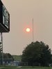
Currently, I'm not flying my new Mini due to the thick smoke hanging around here for the past week.
I'm sure that I would lose sight of it if I gained much altitude or ventured very far from home.
It's been ugly and the effects will be seen for quite a few years from now.
It has been a very strange week, during an extremely strange year!
Stay safe down there, you somehow have even worse smoke than here - it's kind of hard to imagine, even seeing the photos from that area. When the smoke's really thick I find that it messes with the signal pretty badly.
 
Impressive video! Very special light in the first half of the video, looks like doomsday... which perhaps it is if you life in that area. Good luck!
Thanks - it sure feels like doomsday! Trapped indoors with the air outside too toxic to breathe for long, everything drench in malevolent gloom. Going out to film it at least makes me feel proactive!
 
Great video! Does anyone know if flying in that much smoke could damage your drone? I have not been flying my MP 2 in Colorado because of all the smoke. We have days like that one where you can not go outside.
 
I've always wondered about one thing. Does the West Coast have Fire Breaks? Fire breaks are spaced out strips of land with no vegetation that are maintained that way, several hundred yards wide. In western PA., most of the mountains have fire breaks.
The big problem with these fires is the wind. In CA if there is a Santa Anna wind (hot winds from east to west) we get nervous. embers are the real culprit. They can easily jump a break or highway. They can select one house in the middle of others that are untouched. I have a sprinkler on top of my house that a start up at any sign of a fire in the area
 
Rural Southwest Washington, near Longview.
Down here in the desert of central Oregon it looked about the same until yesterday's rain knocked it down. I am also a good 30 miles away from any of the fires and thought about doing the same as this video shows. But in the end, I was too worried the ash from all this smoke might get into my MA2 somewhere where it would do damage and kept myself from flying. Good vid!
 
I viewed the Mt St Helens area video also -both excellent. Really enjoyed the soundtracks. Would understand if you prefer not to reveal who created the music. Was that a modern composer or from a soundtrack provider? I enjoy instrumental music with a darker mood. Either way, excellent choices!
 
1,625 miles east of Portland our skies look much the same albeit a lighter shade - from those same fires
 

Attachments

  • E30F56A1-3701-4799-AE3F-DAB70ECA0CD3.jpeg
    E30F56A1-3701-4799-AE3F-DAB70ECA0CD3.jpeg
    760.5 KB · Views: 6
Beautiful shots, very apocalyptic, fitting score too... Stay safe!
 
Lycus Tech Mavic Air 3 Case

DJI Drone Deals

New Threads

Forum statistics

Threads
131,006
Messages
1,558,809
Members
159,988
Latest member
Allezzov