DJI Mavic, Air and Mini Drones
Friendly, Helpful & Knowledgeable Community
Join Us Now

Litchi Waypoint Mission to Mavic 3 Waypoint Mission converter

Sorry Jeff. I'm still not clear on what screen you are referring to. Is it this one where you press on "Go Fly" to get to the camera view? Perhaps a picture will help us understand.
View attachment 163783

I think you would need to not be connected to the drone. Then you click the "connection guide" button that would be in place of the "go fly" in your screenshot, and then the "camera view" in top right.

I found this initially through this youtube video and then ended up on this forum after some more googling. He uses DJI FlightHub to create the mission, maybe it has some inspiration for what definitions the drone supports. Although I believe the support differs between the enterprise and consumer drones. Flighthub has also changed their UI since that video, but it seems similar enough that it's possible to get it to work.
 
Last edited:
I think you would need to not be connected to the drone. Then you click the "connection guide" button that would be in place of the "go fly" in your screenshot, and then the "camera view" in top right.

I found this initially through this youtube video and then ended up on this forum after some more googling. He uses DJI FlightHub to create the mission, maybe it has some inspiration for what definitions the drone supports. Although I believe the support differs between the enterprise and consumer drones. Flighthub has also changed their UI since that video, but it seems similar enough that it's possible to get it to work.
When I press "Camera View", the screen goes blank.
 
Really interested in making this work, but for whatever reason can’t get the files to move correctly. Is there a way to very simply explain what I need to do to move existing Litchi mission into DJI Fly to allow my M3P fly the mission?
 
Really interested in making this work, but for whatever reason can’t get the files to move correctly. Is there a way to very simply explain what I need to do to move existing Litchi mission into DJI Fly to allow my M3P fly the mission?
See this thread:
 
I'm willing to give this some more test time with my Mavic 3. I have the RC controller with mine, just let me know what I can do to help!
The feedback I have received suggests that everything is working. At this point I would appreciate if people would let me know if any parts of the conversion don't work exactly as expected.

Thanks.
 
It works with my Mavic 3 Classic, but it follow just the waypoints don't move the gimbal or pitch to the POI have to do manually. I didn't test modifying the csv..
 
It works with my Mavic 3 Classic, but it follow just the waypoints don't move the gimbal or pitch to the POI have to do manually. I didn't test modifying the csv..
I need to see two things:

  1. The Litchi mission CSV file that you used as input to the converter.
  2. A Mavic 3 mission KMZ file created with DJI Fly for the Mavic 3 containing a sample POI mission.

With these two pieces of information I can compare my program's output with what your Mavic 3 is expecting and provide a solution.

You can send me a private message with those two attachments.
 
Everytime I start a mission with my Mavic 3, the mission just stops after reaching waypoint one, it's inconsistent sometimes take a photo and does not rotate the gimbal and sometimes it's able to rotate the gimbal, it seems to be related to heading or something.
The FromDJIFly.dat file is a wpml extracted from the kmz created by dji and it works, renamed to .dat to upload here.
And the FromLitchiConverter file is the wpml extracted from the kmz created by the converter, the mission stops after reaching waypoint 1 sometimes make it between 1 and 2, renamed to .dat to upload here.
And the litchi_mission (22).dat is the Litchi .csv file renamed to .dat to upload it here.

Hopefully this can help resolve this issue, since i'm a land surveyor and purchased this Mavic 3 a year ago.
 

Attachments

  • FromDJIFly.dat
    57.3 KB · Views: 2
  • FromLitchiConverter.dat
    979.3 KB · Views: 1
  • litchi_mission (22).dat
    75.5 KB · Views: 1
Everytime I start a mission with my Mavic 3, the mission just stops after reaching waypoint one, it's inconsistent sometimes take a photo and does not rotate the gimbal and sometimes it's able to rotate the gimbal, it seems to be related to heading or something.
I've had a quick look at the files you provided. I'm not seeing any errors in the converted file that might cause the issue you describe.

Your Litchi CSV file contains 525 waypoints. While Litchi can handle a file of this size without a problem, I don't know if the Mavic 3 has any kind of limitations on the number of waypoints it can handle. Have you tried creating a smaller Litchi mission (less than 100 waypoints), converting that to a Mavic 3 mission, and flying that? I would like to eliminate the large number of waypoints as a possible problem for the Mavic 3.
 
I tried with a lot less waypoints also, I noticed quite a few differences between both files. I was able to create two 400+ points missions playing around with stuff, but if I try again it's not consistent.
<wpml:actionGroupStartIndex>2</wpml:actionGroupStartIndex> seems to be incremental in a different way on the DJI Fly files.
and a few other things
If you look at the wpml code you will see some differences between a Mavic 3 mission created in DJI Fly and a Mavic 3 mission created from my utility. Those are to be expected and do not mean there is something wrong.

The "actionGroupStartIndex" parameter points to the waypoint index where the action is to start. The "actionGroupEndIndex" parameter points to the waypoint index where the action is to end. DJI's "groupID" is defined to start at 0 (zero). However, DJI Fly always starts that at 1 (one). That might be one difference you see.

I've converted the Mavic 3 mission you provided to the Litchi CSV format and then back to a Mavic 3 mission. The differences I see between the original and the converted Mavic 3 mission are normal. I am not seeing anything wrong in the converted file that would prevent it from working.

Are you saying that you have never been able to successfully fly a Mavic 3 mission created from my conversion utility?
Once the mission converted was using "Manual" heading for some reason, I manually changed all "Manual" to smoothTransition" and the mission worked, but trying this again on another mission failed. And the second time I changed "Straight Line" to 0 and it worked for that mission, but again did'nt want to work for another mission after.

Edit : both these missions were over 510 waypoints.
Currently, if a POI is defined for a waypoint, the heading mode is set to "towardPOI". Otherwise, if a non-zero heading is defined for a waypoint, the heading mode is set to "smoothTransition". If neither of these are true, I set the heading mode to "followWayline" because that is the default heading mode for the Mavic 3. An earlier version of the converter was setting the heading mode to "manually" if the gimbal mode was set to manual. However, that was an invalid assumption and has been changed.

The "useStraightLine" parameter is set to 1 (one) unless there is a non-zero curve size defined for that waypoint. For the first or last waypoints (since they cannot have a non-zero curve size), I check to see whether or not the adjacent waypoint has a non-zero curve size. I am not aware of a "straightLine" setting in the Fly app and I've only seen Mavic 3 missions with curved lines. However, since the wpml specification includes that parameter, I set it according to the Litchi CSV file.

Your first message said that everytime you started a mission, it stopped after the first or second waypoint. Your later messages seem to be looking for justification of the wpml parameter settings. If you want to learn how these parameters are defined, DJI has documentation on them here:


If your goal is to see why one of your missions does not execute I need to see the original Litchi CSV file and an equivalent mission created in DJI Fly that does work. Your initial DJI Fly mission used different heading modes and contained different actions from the CSV provided. It doesn't matter to me if the GPS coordinates or heights are different. This would be easiest with a relatively small mission.
 
Really interested in making this work, but for whatever reason can’t get the files to move correctly. Is there a way to very simply explain what I need to do to move existing Litchi mission into DJI Fly to allow my M3P fly the mission?
Its all explained on the INSTRUCTIONS Pages Link HERE
... but here is my take 'for DUMMIES' ;)

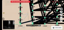
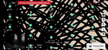
* Get your Litchi Mission into the Mission Hub.
* Export your Mission as a CSV File - to a Preferred folder lets call it folder XXX
* Run your CSV through DJ WES's Online Utility to Convert the .CSV to a .KMZ which you will download from the Utility into Folder XXX ### (note the ### we will return here)
(see converter Link HERE )

That was the Easy Part.... Now the worst part

Waypoints Files on DJI FLY on the DJI-RC - is stored in the waypoints folder.
You can locate this in the file Explorer by swiping down on FLY and hitting the Hexagon (Top Right)
but you dont get a fully open Explorer here - ...
TO get full access >Locate Storage > internal storage > Music and Audio > and click on Audio files
... Then click on the top left of the page (three lines)
to get a mini explorer on the bottom left -

Now navigate (at the bottom Left) to :
dji rc > Android > data > dji.go.v5 > files
... and then scroll down to the bottom of the Page...
you will see waypoint *** (note the *** we will return here)

If you click into waypoint it opens up a list of folders - with Long checksumID names (Each of these represents a custom Waypoint folder that you have created in Waypoints) - AND if you click on any one of them you will finally find the same ID but with the extension .KMZ
(also there may be an image folder which may retain a camera image or a Map)
BUT... the KMZ file is the one that needs to be replaced somehow by the New KMZ created (See ### above)
... AND ... you have to KEEP the Same Complicated Long Name of the KMZ file.

Replacing this is Not too Easy because the DJI-RC is 'Overprotected' and does not allow easy Replacement or updating.
Furthermore I found this impossible to find on the PC Explorer - because when hooking up with my PC (via USB), somehow android permissions makes this section INVISIBLE

Bringing in the LITCHI KMZ
So my method - was (as was suggested somewhere)

1) On the DJI-RC Fly app, Create a DUMMY Waypoint while Flying (two points will do) - This creates a new entry (with a New RandomID name folder) in waypoint folder .

2) Stop the Flight - Use the above method to locate the WHOLE waypoint folder (see *** above) - and copy this ENTIRE FOLDER and Contents - to an accessable folder maybe on the Memory card. (It must be a place accessable to copy and replace by your PC or Phone)

BTW: Copying in the RC explorer is done by CLICKING (and Holding the Folder) till a check mark appears, then using the Top Right hand Menu ... to select copy to... - then navigate to your destination folder - and hit the COPY button at the bottom right)

3) in my case I put it in the DCIM folder of my Memory card.

4) then You can connect your RC to your Computer or Phone (USB3) or Just take out the Memory card from the RC - to your computer -and operate on the folder.

5) Locate the DummyID KMZ in the (Same Name) DummyID folder
... this may be tricky because all folders look similar (except for the ID) - but I used the "Map_preview" folder which holds images of maps of your waypoints to locate the right ID for my 'Dummy' - and...
Finally change the Dummy KMZ file to be your New KMZ file (see ### above) - by deleting the dummy and retaining the DummyID name for the new .KMZ file.

6) Now copy the whole waypoint folder back from the card to the correct position on the DJI RC - by replacing the Original waypoint folder. (see *** above)
NOTE: - if permissions are a problem - it will not overwrite, and instead adds a waypoint(1) - you will need to delete the orginal and rename the new one to just waypoint

Then YOU're DONE - Go out and FLY -
Your Dummy now has your Litchi Mission. (Be careful tho, the Mavic Waypoint missions force Bezier curves which may cause S shaped between a straight route to round the corners.) -
Someone proactively commented that to get almost straight lines between points one can insert TWO points at a Waypoint (close to each other) - that takes care of the Curve.

Have Fun !

WOW !!!! Im looking at my text above - This is a REAL MISSION to do !!!! but doable Quickly when you have done it once

Hope this helps some desperate person (LOL)
 
Last edited:
  • Like
Reactions: Facherty and DJ Wes
Currently, if a POI is defined for a waypoint, the heading mode is set to "towardPOI". Otherwise, if a non-zero heading is defined for a waypoint, the heading mode is set to "smoothTransition". If neither of these are true, I set the heading mode to "followWayline" because that is the default heading mode for the Mavic 3. An earlier version of the converter was setting the heading mode to "manually" if the gimbal mode was set to manual. However, that was an invalid assumption and has been changed.

The "useStraightLine" parameter is set to 1 (one) unless there is a non-zero curve size defined for that waypoint. For the first or last waypoints (since they cannot have a non-zero curve size), I check to see whether or not the adjacent waypoint has a non-zero curve size. I am not aware of a "straightLine" setting in the Fly app and I've only seen Mavic 3 missions with curved lines. However, since the wpml specification includes that parameter, I set it according to the Litchi CSV file.

Your first message said that everytime you started a mission, it stopped after the first or second waypoint. Your later messages seem to be looking for justification of the wpml parameter settings. If you want to learn how these parameters are defined, DJI has documentation on them here:


If your goal is to see why one of your missions does not execute I need to see the original Litchi CSV file and an equivalent mission created in DJI Fly that does work. Your initial DJI Fly mission used different heading modes and contained different actions from the CSV provided. It doesn't matter to me if the GPS coordinates or heights are different. This would be easiest with a relatively small mission.
Ok so from my understanding it is caused by the ActionId numbers not being incremental properly in the converter file, I created two 200 waypoint similar missions, one using litchi and the other one using dji fly. If you look at the map of the paths it creates with the litchi/converter, is makes no sense. It's trying to follow actionid and groups that start at wrong numbers and don't increment properly. I sent you the files to analyse by pm
 

Attachments

  • 357931972_943678303532653_7386253720925800501_n.jpg
    357931972_943678303532653_7386253720925800501_n.jpg
    126.1 KB · Views: 6
  • 357984657_6342709149159269_4183808976303690708_n.jpg
    357984657_6342709149159269_4183808976303690708_n.jpg
    146 KB · Views: 6
This is the lines that are not incrementing properly.
From Orginal Dji Fly file : <wpml:actionGroupStartIndex>3</wpml:actionGroupStartIndex>
<wpml:actionGroupEndIndex>4</wpml:actionGroupEndIndex>

And from the converter it becomes :

<wpml:actionGroupStartIndex>3</wpml:actionGroupStartIndex>
<wpml:actionGroupEndIndex>3</wpml:actionGroupEndIndex>

There seem to be more to it then that with action groups and action id, seeming to cause conflicts and making the drone stuck in a loop.
 
Last edited:
Lycus Tech Mavic Air 3 Case

DJI Drone Deals

New Threads

Forum statistics

Threads
131,096
Messages
1,559,791
Members
160,077
Latest member
svdroneshots