DJI Mavic, Air and Mini Drones
Friendly, Helpful & Knowledgeable Community
Join Us Now

Virtual Litchi Mission

I have never needed more than 99 waypoints in a mission - I always run out of battery before I run out of waypoints!
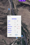
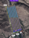
I have done grid missions in mountain areas where I have run out of waypoints due to the quickly varying terrain height and the need to place waypoints at distances of 5m. Realistically “thousands” would never be needed but 250 would be handy.

Regards
Ari
 
VLM can already process missions of more than 99 waypoints - try it and see!

However, the helix and grid options cannot CREATE missions more than 99 waypoints - perhaps that is what you are referring to.

I can easily increase that limit if required but I would like to keep some limit in place to prevent users unintentionally generating enormous missions with thousands of waypoints.

I have never needed more than 99 waypoints in a mission - I always run out of battery before I run out of waypoints!

What would you like the limit to be?

N
I am new on this stuff with a dji drone but I have used mission planner to fly merged two flight (two batteries) one hour missions, I wonder if it would be possible to do it with litchi and your program. It would be nice to just set it to the maximum waypoints litchi is capable to handle even that we never use all of them at the same time.
 
Virtual Litchi Mission version 2.7.2 now available for download

Link can be found in the first post of this thread.

By request, the helix and grid options can now generate missions up to 250 waypoints.

Also includes a few minor bug fixes which are not worth talking about!

N
You are a star of the first order! 👍

Thanks!
 
Hello
I don't know if the subject has been covered here, but I have a strange problem with Chrome Litchi Virtual Mission plugin in Firefox 101 the plugin does not work unless I am in private browsing, if I want to export in VLM format i have this message , View attachment 149766
Please open Developer Tools and pm me screenshot from Console tab when getting this error.
 
i am trying to understand how this work, is there any way to chose how often to take the pictures??
There are two ways to take photos as part of a waypoint mission in Litchi:

1) You can take a photo as one of the "Actions" at a waypoint
2) You can specify the interval in distance or in time to take a photo between waypoints.

Note that VLM handles the first of these but not the second.

N
 
Virtual Litchi Mission version 2.7.2 now available for download

Link can be found in the first post of this thread.

By request, the helix and grid options can now generate missions up to 250 waypoints.

Also includes a few minor bug fixes which are not worth talking about!

N
Hi!
In the V2.7.2 version of the program, two errors came out.
1. Is it impossible to implement a grid, an error comes out? As you can see from the screenshot.

2. When playing a video by link, an error pops up after closing. You can watch it on the Video.
There is no way to attach a video.:(
 

Attachments

  • 2022-07-05_12-21-04.png
    2022-07-05_12-21-04.png
    4.3 MB · Views: 13
  • 2022-07-05_12-31-37.png
    2022-07-05_12-31-37.png
    2.7 MB · Views: 13
Hi!
In the V2.7.2 version of the program, two errors came out.
1. Is it impossible to implement a grid, an error comes out? As you can see from the screenshot.

2. When playing a video by link, an error pops up after closing. You can watch it on the Video.
There is no way to attach a video.:(
1) The grid option requires the mode to be set to "Straight Lines" in Litchi Settings.
2) I can link to your video quite OK - do you have the problem with all videos or just this one?

Capture.JPG

N
 
  • Like
Reactions: borodaagvali
Namirda!
Can't understand the logic of making a GRID?
Having set three points of interest on the map, I click on the make a grid button.
Should the grid be drawn inside the boundaries of the point of interest 1 - 2 and 3 ?

In fact, the grid is obtained inside the point of interest 1 - 2, and goes beyond the boundary of point 3, why so?
Did you try to show everything in the screenshot?
 

Attachments

  • 1.png
    1.png
    1.6 MB · Views: 19
  • 2.png
    2.png
    1.1 MB · Views: 19
  • 3.png
    3.png
    1.5 MB · Views: 20
Has there been any discussion about increasing the overlap?
I would like to get to 75% overlap if possible.
No discussion necessary - I simply didn't think it would ever be required.

I will increase the max overlap to 75% in the next release.

N
 
Hello,

I want to give you an idea for this tool:

Writing something in the sky, like checking the fly path after using the drone, and the path would be a word or a sentence.

I am a c programmer in automotive world, with some free time to spare. Contact me if I can give you a hand maintaining the tool.
 
No discussion necessary - I simply didn't think it would ever be required.

I will increase the max overlap to 75% in the next release.

N
Just for context, I’ve been asked for 80% overlap when doing mountain slope survey. I can’t tell you the exact reason as I didn’t process those images only collected them but what the customer asks for the customer gets of course.

Regards
Ari
 
Hi guys, first of all i want to thanks all the people who are supporting the VLM, i ask if some of minor changes are possibile to make for example:
increase the zoom on the map in the app
possibility to increase the overlap to 80% maximum
possibility to eventually make cross grid missions
I can say i love the app, and it's really handy for me, because i'm learning terrain and building mapping.
Keep up the good work!!
 
  • Like
Reactions: borodaagvali
Hi guys, first of all i want to thanks all the people who are supporting the VLM, i ask if some of minor changes are possibile to make for example:
increase the zoom on the map in the app
possibility to increase the overlap to 80% maximum
possibility to eventually make cross grid missions
I can say i love the app, and it's really handy for me, because i'm learning terrain and building mapping.
Keep up the good work!!
I completely agree with you!
 
  • Like
Reactions: UberPizius
VLM V2.7.3 is now available for download - the link is in the first post of this long thread.

It is only a bugfix release - no new features and so unless you were having some issues with V2.7.2 there is no need to upgrade.

Fixes are:

1) Fixed error in grid definition - ( See post 1052 from @borodaagvali )
2) Fixed bug where "Focus POI" was used but no POI specified.
3) Max grid overlap increased to 80% as requested.

N
 
Lycus Tech Mavic Air 3 Case

DJI Drone Deals

New Threads

Forum statistics

Threads
131,233
Messages
1,561,078
Members
160,185
Latest member
Tarizzman