DJI Mavic, Air and Mini Drones
Friendly, Helpful & Knowledgeable Community
Join Us Now

Air 2s DashWare The Free Telemetry Program

I am working on trying to make one profile for the Mavic 3.
 
  • Like
Reactions: Jagerbomb52
Very interesting. Here's a link to the website I found for Dashware.


@Augustine, the video on the How it Works page shows as unavailable.

Thanks for sharing this.
 
Very interesting. Here's a link to the website I found for Dashware.


@Augustine, the video on the How it Works page shows as unavailable.

Thanks for sharing this.
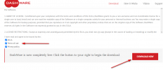
If you go to the download page and click all three boxes then hit download it will download.
There a some older tutorials on Youtube that will help you get going. screenshot-www.dashware.net-2021.11.19-17_42_34.png
 
  • Like
Reactions: MS Coast
If you have never used the program before watching a few tutorials on youtube will help.
One thing about Dashware it does not like 4K or higher. I always downsize my videos to 1080. This makes rendering times faster and since it is just getting uploaded to youtube who really cares about high resolution as it gets lost on youtube anyways.
The other thing is to under stand how gauges work. They need info from the telemetry file to show a reading. Using the CSV file from Airdata works perfectly for the Air 2S and I would think pretty much any of the other mavics.
Dashware will also load the GPX file but I have found some data to be missing from the GPX file.
Once you get things figured out you can save your gauges as a template for later use by just replacing the new telemetry and video file down the road.
There is a learning curve but if you use Youtube to help figure things out is all comes together pretty fast.
Good luck.
 
I hate paying for programs when others will do pretty much the same for free.
Depending on your skill level it is very easy to do.

Northern Ontario
Sunrise 8:11 EST
Sunset 17:14 EST
9.33 AM
21.8 °f


Love my retirement, esp in a rural area. Hate going to big cities now with traffic and craziness. Also have a lot of drone things to do - esp waterfalls and mountains.
 
  • Like
Reactions: Jagerbomb52
If you have never used the program before watching a few tutorials on youtube will help.
One thing about Dashware it does not like 4K or higher. I always downsize my videos to 1080. This makes rendering times faster and since it is just getting uploaded to youtube who really cares about high resolution as it gets lost on youtube anyways.
The other thing is to under stand how gauges work. They need info from the telemetry file to show a reading. Using the CSV file from Airdata works perfectly for the Air 2S and I would think pretty much any of the other mavics.
Dashware will also load the GPX file but I have found some data to be missing from the GPX file.
Once you get things figured out you can save your gauges as a template for later use by just replacing the new telemetry and video file down the road.
There is a learning curve but if you use Youtube to help figure things out is all comes together pretty fast.
Good luck.
There is a easy work around for this. Once you finish your video ready for export or render, then put a green screen in the video and you will have just telemetry over the green screen, the in premiere or davinci import that and put the original video and import the overlap video and you can make disappear the green just leaving the overlap in the max resolution. I forget the utility name. I will find it.
 
  • Like
Reactions: Jagerbomb52
I know there is a fellow on this forum selling his 99 dollar program but to be honest it is way over priced. Even RaceRender a professional program for all kinds of activities is only $59.95 US bucks for the Ultimate Edition.
Yes support for Dashware has stopped but there are so many people keeping it going and its still worth while learning and using for the few times that we might want to add some telemetry to our videos.
The more help, the more templates that get shared I am sticking to something that is free.
I like free. ;)
 
  • Like
Reactions: zeusfl
There is a easy work around for this. Once you finish your video ready for export or render, then put a green screen in the video and you will have just telemetry over the green screen, the in premiere or davinci import that and put the original video and import the overlap video and you can make disappear the green just leaving the overlap in the max resolution. I forget the utility name. I will find it.
I watched this video on how to make a green screen. Is there a easier way?
 
Well I played around with the green screen addition today. Being a old dog who does not like learning new tricks it was actually pretty easy to use. Not sure if the added resolution you would get from doing this is worth it but for some it might be.
Not very nice outside for flying so using my spare time on the learning curve :)

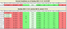
screenshot-www.uavforecast.com-2021.11.21-14_20_04.png
 
Here is another one I made up using some DJI, Yuneec and Parrot gauges. Still working on the green screen option as I have to many projects on the go to devote more time to it. Getting colder here so maybe next week.

 
Lycus Tech Mavic Air 3 Case

DJI Drone Deals

New Threads

Forum statistics

Threads
131,566
Messages
1,564,291
Members
160,459
Latest member
datkin