DJI Mavic, Air and Mini Drones
Friendly, Helpful & Knowledgeable Community
Join Us Now

Virtual Litchi Mission

This is a post from one of the other users with the same problem, as you can see the ALTITUDE is different and has been lowered to almost nothing.

Andrew_Bennett
Today when exporting a mission as VLM, All value are off by about 276.
Yesterday a specific gx:FlyTo tag was 279.1071800256566, today it’s 3.0480369592503744
Yesterday KML file snippit …
<gx:FlyTo>
<gx:duration>0</gx:duration>
<gx:flyToMode>smooth</gx:flyToMode>
<Camera>
<latitude>45.16872624820793</latitude>
<longitude>-93.1240527313689</longitude>
<altitude>279.1071800256566</altitude>
<heading>135.0</heading>
<tilt>90.00000003779164</tilt>
<roll>0</roll>
<altitudeMode>absolute</altitudeMode>
<gx:horizFov>48.808874951732385</gx:horizFov>
</Camera>
</gx:FlyTo>

Today KLM file snippit …
<gx:FlyTo>
<gx:duration>0</gx:duration>
<gx:flyToMode>smooth</gx:flyToMode>
<Camera>
<latitude>45.16872624820793</latitude>
<longitude>-93.1240527313689</longitude>
<altitude>3.0480369592503744</altitude>
<heading>135.0</heading>
<tilt>90.0</tilt>
<roll>0</roll>
<altitudeMode>absolute</altitudeMode>
<gx:horizFov>48.808874951732385</gx:horizFov>
</Camera>
</gx:FlyTo

Here is another comment from the Litchi Forum describing the situation perfectly:
Sam_G
23h

Same problem here. When you try to fly a virtual mission, its burrowing underground.
And when you check Waypoint info in the Diagnostics of Google Earth Pro, it shows the wrong altitude.
Hi Steve,

That's interesting.....

1) Can you please confirm that you are using VLM 2.8.1
2) Where do those kml snippets come from? They don't quite look like those generated by VLM
3) Please post a link to your mission (untick the private checkbox first) and I will take a look at it.

Thanks

N
 
I’m also having this issue. Just started today. It has to be something in VLM, as i can pull up virtual missions that were generated in the past and they look fine. Nothing changed on my end recently, litchi or the VLM portion of Litchi had to have been updated.Also getting the same issue using Firefox on Android with Google earth Pro.
It appears that VLM isn't taking the ASL altitude into consideration (i want 30m, but my takeoff point is 200m ASL, so it needs 230, but is sending 30)
 
Last edited:
This is the follow up post from Andrew from the Litchi Forum: Mission Export as VLM to View Flight in Google Earth Pro Bug
Andrew_Bennett
2h

I’m using the same computer.
Edition Windows 11 Home
Version 22H2
Installed on 10/‎13/‎2022
OS build 22621.963
Experience Windows Feature Experience Pack 1000.22638.1000.0
As a test right now using a different mission, if I use the Missions Export as KML 3D Path option, the download text file altitude values are correct and looks right in Google Earth Pro …
<name>Start Point</name>
<styleUrl>#startpin-style</styleUrl>
<Point>
<altitudeMode>absolute</altitudeMode>
<gx:drawOrder>1</gx:drawOrder>
<coordinates>-93.1240527313689,45.16872624820793,278.54803705215454</coordinates>
</Point>

But if I Extract as VLM the altitude is not correct in the download text file and therefore does not look right in Google Earth Pro …
<gx:FlyTo>
<gx:duration>0</gx:duration>
<gx:flyToMode>smooth</gx:flyToMode>
<Camera>
<latitude>45.16872624820793</latitude>
<longitude>-93.1240527313689</longitude>
<altitude>3.0480369592503744</altitude>
<heading>135.0</heading>
<tilt>90.0</tilt>
<roll>0</roll>
<altitudeMode>absolute</altitudeMode>
<gx:horizFov>48.808874951732385</gx:horizFov>
</Camera>
</gx:FlyTo>

I think we are possibly mixing things up here. "Export as VLM" is an option in "Chrome Litchi Virtual Mission" which is a Chrome Extension offering similar functionality to VLM. The Chrome extension was developed later and separately from VLM and the source code is different.

It is the windows application called Virtual Litchi Mission (VLM) which is the subject of this thread.

Do you see the same problem in VLM?

Thanks

N
 
Thanks namirda. Sorry to have bothered everybody here. We finally had a post in the Litchi Forum that helped isolate where the problem is. While we don't have a solution yet for the extension, we understand why you can't help. Thanks again. S (time to get the Windows version!)
wesbarrisLeader

22m

I don’t think anyone here has made it clear which version of VLM is producing this error.
I use the VLM Windows application written by Namirda. It is still properly sending flight paths with the correct elevation to Google Earth Pro for me.
There is also a Chrome and Firefox VLM extension which is a different piece of software than the VLM Windows application. It was written by someone else.
When you say VLM has a bug, you should make it clear which VLM you are referring to. Either the browser extension or the Windows application.
 
Last edited:
Hello namirda, thanks for your help. Let me try to answer your questions from the start.

1. Both my computers are using the same Chrome Browser Extension version 0.2.1 This was the version that I downloaded for my new laptop 3 weeks ago.
2. This is the Litchi member that posted the information, so please message him for more information. Andrew_Bennett
3. Mission Hub - Litchi Mount Rushmore
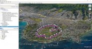
Mission Hub - Litchi Diamondhead Crater
On my older Windows 10 computer everything still works great and all missions play as before. On my new computer, (same settings) all the same missions fail to work properly. Yesterday was the first time I tried to run a VLM so I can't say if it worked before Jan 1.

"Do you see the same problem in VLM?" On our computers the option to export is in RED and says "EXPORT as VLM" and they seem to have started having problems on Jan 1. Some of the information that was described may be incorrect, but we are all seeing the same problem with the same symptoms and behavior. I can't say for sure who else is using the Extension and who is not. Thanks again for your time and attention. S

"The Chrome extension was developed later and separately from VLM and the source code is different.

It is the windows application called Virtual Litchi Mission (VLM) which is the subject of this thread."

Are you saying that anybody that uses the VLM Chrome Browser Extension can't get any help here?
I have just taken a look at the mission linked above called Mount Rushmore. I have flown the mission in VLM 2.8.1 and I cannot seen any problem with it. See below.

Rushmore.JPG


I believe you are using the Chrome extension rather than Virtual Litchi Mission (VLM).

VLM is a windows application that you must install - the download link is in the first post of this thread. If you are using windows then I suggest you give it a try.

Sorry - I have never used the Chrome Extension so I cannot help you if that is where the problem lies.

N
 
  • Like
Reactions: Steve Amerson
I have just taken a look at the mission linked above called Mount Rushmore. I have flown the mission in VLM 2.8.1 and I cannot seen any problem with it. See below.

View attachment 159011


I believe you are using the Chrome extension rather than Virtual Litchi Mission (VLM).

VLM is a windows application that you must install - the download link is in the first post of this thread. If you are using windows then I suggest you give it a try.

Sorry - I have never used the Chrome Extension so I cannot help you if that is where the problem lies.

N
Thankyou namirda, for your time and assistance. Myself and the other Litchi users having problems didn't understand that the Browser Extension was not covered in this Forum but we understand now. Have a great day! (time to try your version!)
 
I have just taken a look at the mission linked above called Mount Rushmore. I have flown the mission in VLM 2.8.1 and I cannot seen any problem with it. See below.

View attachment 159011


I believe you are using the Chrome extension rather than Virtual Litchi Mission (VLM).

VLM is a windows application that you must install - the download link is in the first post of this thread. If you are using windows then I suggest you give it a try.

Sorry - I have never used the Chrome Extension so I cannot help you if that is where the problem lies.

N
Sorry about getting the missions backwards! You are right about my using the Browser Extension.
 
Hello, This app was recently brought to my attention as I was having the same altitude issues with Google Earth Pro using the Litchi online mission planner. I downloaded and installed the latest version which installed itself and a Virtual C something or another on my Dell laptop. I then was able to successfully view my first Litchi mission just fine on the first try. Each time I made some adjustments to the mission, I could view it without any issues until a day ago. Now the app loads with the DJI sound but no app to see. Just a blank screen. If I mouse over the logo on my Taskbar, I can see a clear thumbnail of what I should see on the screen. I have tried uninstalling the app and reinstalling it twice but I still get the same results. Can anyone of you help me get this app going again? Any help would be appreciated.
 
Hello, This app was recently brought to my attention as I was having the same altitude issues with Google Earth Pro using the Litchi online mission planner. I downloaded and installed the latest version which installed itself and a Virtual C something or another on my Dell laptop. I then was able to successfully view my first Litchi mission just fine on the first try. Each time I made some adjustments to the mission, I could view it without any issues until a day ago. Now the app loads with the DJI sound but no app to see. Just a blank screen. If I mouse over the logo on my Taskbar, I can see a clear thumbnail of what I should see on the screen. I have tried uninstalling the app and reinstalling it twice but I still get the same results. Can anyone of you help me get this app going again? Any help would be appreciated.
Hi,

Try starting VLM while holding down the ctrl key. You will be given the option to reset VLM to initial conditions.

This can happen if VLM shuts down abnormally for some reason.

N
 
Hi,

Try starting VLM while holding down the ctrl key. You will be given the option to reset VLM to initial conditions.

This can happen if VLM shuts down abnormally for some reason.

N
Thank you for that advice! It worked to fix the problem. I just now saw your post. For some reason, I did not receive a notification email of your response. Thanks again!!Thumbswayup
 
Download latest version here :
Virtual Litchi Mission V2.8.1

---------------------------------------------------------------------------------------------------------------------

VLM Frequently Asked Questions

Problems Getting Started


Q) VLM does not start properly – startup sound and splash screen and then nothing!
A) Restart VLM while pressing CTRL and you will be given the option to reset VLM to initial conditions

Q) The Litchi Mission Hub panel in VLM is shifted from its expected location?
A) Try running in compatibility mode by right clicking on the VLM icon and choose

Compatibility tab -> Change High DPI Settings -> High DPI Scaling Override.

Q) VLM runs but Google Earth does not open?
A) Check that Google Earth Pro is properly installed and that kml files are properly associated with Google Earth. You can check this by double clicking on a kml file and confirming that Google Earth opens.

Q) VLM crashes on startup complaining about 'CefSharp.Core.dll' or one of its dependencies.
A) Check that the following are properly installed on your system:
Microsoft Visual C++ 2015 - 2022 Redistributable (x64)
Microsoft .NET Framework 4.6

Q) Can I run VLM on a Mac?
A) VLM is a windows only application. You have two options to run on a Mac or Linux machine

1) Apparently VLM runs well in a Virtual Machine such as Parallels​
2) User Bazuchan has implemented a version of VLM which runs as an extension to the browser. Yet another Virtual Litchi Mission (Google Chrome Extension)
Q) I get a message about my quota being exceeded - what's up?
A) VLM uses the Google Elevation API to get its elevation information using an API key which is shared between all users. If usage of this key exceeds a certain daily limit then you will need to either wait until the next day when the quota is reset - or else get your own key from Google. You can open an account with Google at https://console. cloud.google.coms. Google will require you to enter your credit card details but unless your usage of VLM exceeds 40,000 hits in a month you should not be charged anything. You can enter your own API key into VLM in the Google Tab of VLM Settings.

Problems with the Virtual Mission

Q) The elevations of my virtual mission look wrong
A) Check the following:
1) The exaggeration factor in Google Earth should be set to 1.0​
2) Check that the VLM Home Point Reference Altitude is appropriate for your mission. If you are unsure then use the default setting of WP1 and put the first WP of your mission directly above the Home Point (Take Off Point)​
3) If there are still small elevation differences then compare the elevation of the Home Point in both Google Earth and Google Maps (ie Litchi). If they are significantly different then set the VLM HP altitude to the elevation measured by Google Earth.​

Q) The VLM Mission is a poor match with the real mission
A) Check the following:
1) Check that you have specified a heading and gimbal angle for every waypoint of your mission. If any of these values are undefined you will see an orange warning in the VLM Activity Log.​
2) Check that your mission does not exceed the capabilities of your drone. Any such issues will be highlighted in orange in the VLM Activity Log and should be addressed.​
3) Check that the Google Earth viewing window is set to 16:9 to match your camera settings.​
4) Check that the drone type is set correctly in VLM and that the FOV setting is correct.​
5) If the VLM mission is jerky then try increasing the number of smoothing points.​

If you still have questions or problems then please ask in this thread.
---------------------------------------------------------------------------------------------------------------------------

Original post dated 26/12/2017:

In this thread started almost a year ago - https://mavicpilots.com/threads/how-hard-would-it-be-to-simulate-litchi-missions-in-google-earth.7864, user “torqum” introduced the intriguing idea ‘flying’ a Litchi mission virtually in Google Earth to see how it looks from the perspective specified in Litchi. It was a very appealing concept – to fly a mission anywhere in the world without getting out of your armchair!

In that thread, user "JTS" submitted a conversion program which apparently worked for some folks but not for others – and not for me so I decided to write my own.

The utility is called Virtual Litchi Mission (VLM) – it is a standalone executable and does not need any installation. It runs on my Win10 x64 machine but should run on x86 machines as well. On older versions of windows your mileage may vary…..

VLM sets a watch on a user specified Downloads folder and will automatically read any csv file created in this folder. When Litchi Mission Hub writes a csv file to this folder, VLM will convert it to a “Tour” in Google Earth including the complete camera orientation and gimbal settings which were specified in Litchi.

The resulting Virtual Mission can then be flown in Google Earth and should show results very similar to that obtained when the mission is flown with your drone. I have tried it out on quite a few of the public missions available in Litchi Mission Hub and in areas where the satellite imagery is good, the results are impressive. Google Earth is so amazing!!

I have found VLM useful to check that there are no erroneous parameters in my Litchi Mission and to check that the camera ‘sees’ what I want it to see. It has saved me several wasted flights with my mavic.

A full User Guide is available in VLM under the Help Tab

Please give VLM a try and let me have any feedback, comments etc. I hope you find it useful.

Thanks

N
Great Piece of Software.

I still have some probs. Perhaps someone can help oder give advice.
I am using Samsung Galaxy S10, Mini 2 an litchi.

I try to fly waypoints with automatic photos but there are no photos taken.

I can load the eaypoint route and its flys the correct points, but no photos are taken.

can anyone help ?
Make sure your mission doesn't have curved turns
 
  • Like
Reactions: OzoneVibe
Good morning guys
When I try to create a Grid Mission for a large area, the VLM limits me to 250 pois, which makes large mappings unfeasible. Wouldn't it be possible to increase this limit?
I do mappings with Mavic 3
 
Good morning guys
When I try to create a Grid Mission for a large area, the VLM limits me to 250 pois, which makes large mappings unfeasible. Wouldn't it be possible to increase this limit?
I do mappings with Mavic 3
Welcome to the forum!

What is the limit for Litchi? I would have to look it up..

Rod
 
Lycus Tech Mavic Air 3 Case

DJI Drone Deals

New Threads

Members online

Forum statistics

Threads
134,445
Messages
1,594,852
Members
162,982
Latest member
Roel Hopstaken